
 |
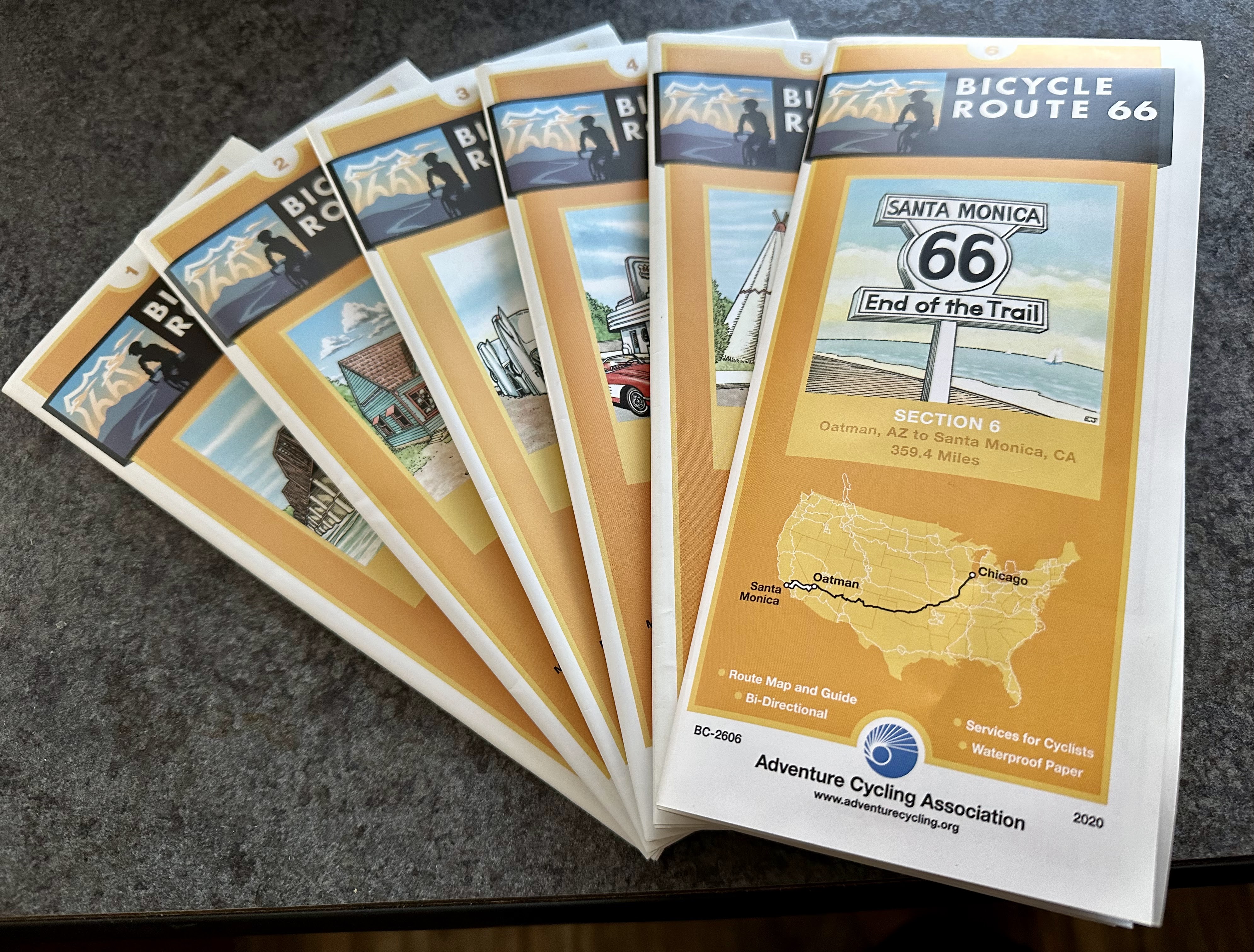
| Set of Adventure Cycling Association Bike Route 66 Maps |
There are many resources available to help cyclists plan a tour route confidently, especially for trips in the US. A few resources I rely on for route planning are Crazy Guy On A Bike and Cycle Blaze blogs, GPS route maps on Strava, Garmin and RideWithGPS as well as Adventure Cycling Association maps. For me, the biggest consideration for deciding on a route will be the time of year and associated weather conditions. Since my next tour will be in the US, I'll concentrate on what factors helped me decide on this upcoming route.
************************************************************************************
.png)
***********************************************************************************
The US is a very big country with specific regions and varied terrain. Each region has it's own weather concerns. At the moment, I happen to be in the desert of Southern California where the heat will become unbearably hot and even dangerously high during the summer months. The heat of the desert is what helped me decide when I'll be starting my tour. Come April, temperatures will climb to the high 90's. I set March 1st as a start date. My other consideration for when to start the tour is attempting to plan for dates where I want to be in certain places. There are many people I want to meet up with and places I want to visit but the only real, non-flexible date I have is to be at the 25th annual Recumbent Retreat on the Oregon Coast September 7th. I want to be in Portland the 1st week of September to spend a few days visiting friends before I do the 2 day ride to Warrenton, Oregon where the retreat is held every year at Ft. Stevens State Park. I'll have to cycle 7,000 miles to make this event. I've given myself 6 months for this ride.
Many people love going 'old-school' using a paper map while other cyclists prefer using GPS files to download on to their Garmin style cycling computer and others, still, will simply use Google maps on a mobile phone for navigation.
 |
| All the map panels for one section |
 |
| Section 6 information |
How did I pick my route? I'll be starting the tour from a Catholic church in Bermuda Dunes, California where I've been staying over the winter. My dear friend, Joni, is very generously letting me park my truck and trailer while I go on this cycling trip. Since I've already done the Southern Tier bike route twice, I decided to do something new picking bike route 66. This is a bonafide bike route which appeals to me for a few reasons. Personally, I think the US is one of the most dangerous countries in the world for cycling. The biggest difference between cycling in the US and other countries is the lack of US cycling culture. Most other countries have a strong cycling sport culture while most of the US passionately hates cyclists especially cyclists on the roads. Even though Bike Route 66 is all road riding, I'll feel safer taking a route designed for cyclists.
 |
| Points of Interest |
 |
| Section weather and route highlights |
 |
| Field notes of attractions |
 |
| Available services in each town |
Adventure Cycling Association is a bike advocacy company out of Missoula, Montana. They have been in the business of designing bike routes with accompanying maps since the 1970's. Bike route 66 is one of their newer routes. The available maps include all the information I'll need from the start in California to where I'll take the route in Missouri. I try to use the routes designed by Adventure Cycling Association whenever I can for long distance rides in the US. Why reinvent a route when a perfectly good one already exists? Not having to plan the actual route makes doing the ride much easier. The maps for this route are available to buy in paper and also for downloading to a cycling computer like a Garmin. I bought the paper maps. These maps include elevation profile and list of all services available in each town. The maps divide the route into sections. Bike route 66 has 6 sections. There is a folded map for each section. One side of each map has an overview of the section with valuable information including weather, services, road conditions and points of interest. The other side is divided into panels with the actual map route that can be folded for use in a handlebar bag map case.
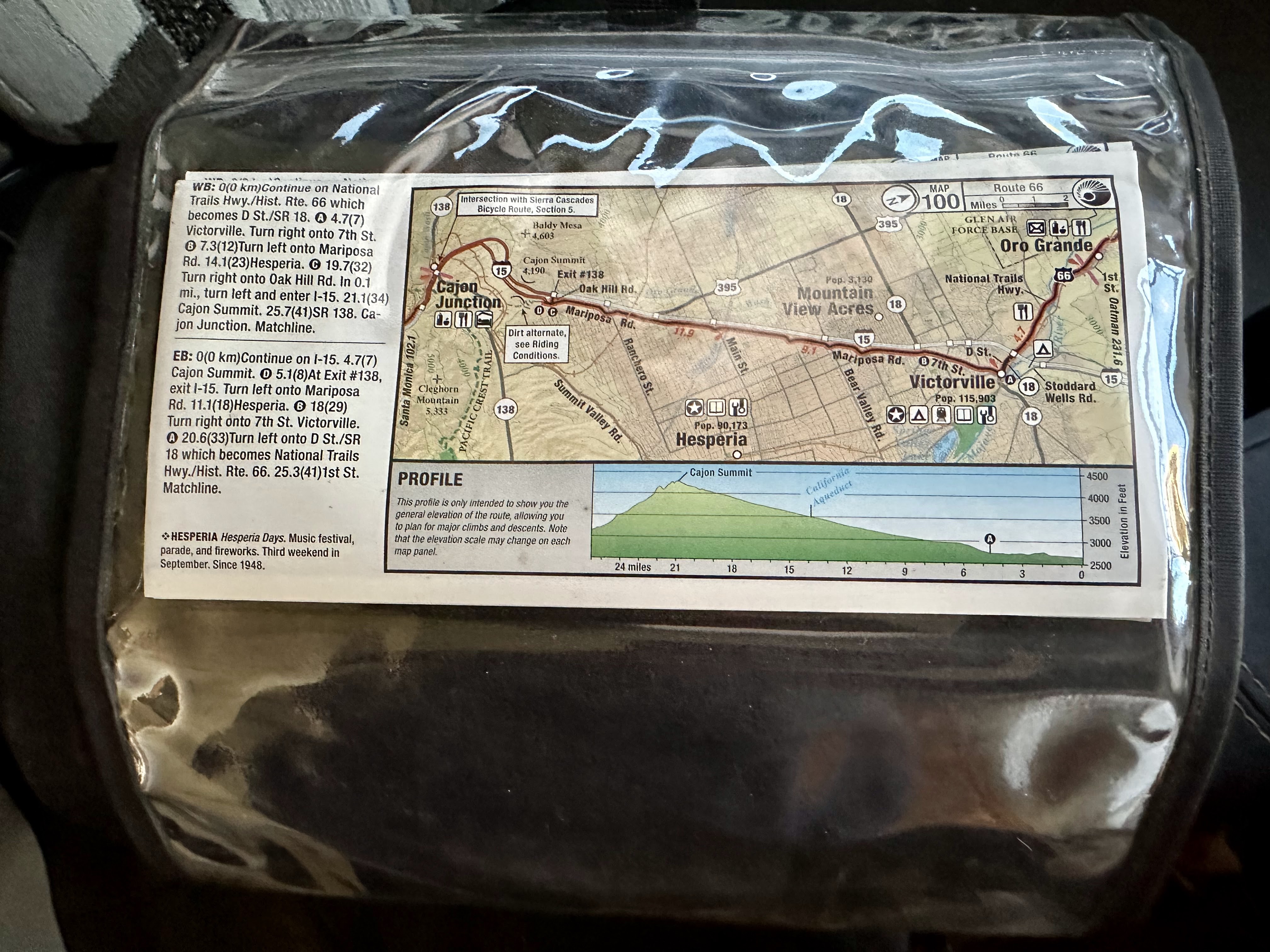 |
| Panel in my handlebar bag map case |
 |
| Close-up of a panel and start of my tour route with written directions on the left side. |
Lots of other cyclists have already done this route and much more information is available online from blogs, YouTube videos, Strava, Garmin and RideWithGPS data files. For me, it's reassuring to read other cyclist's accounts of their rides. Aside from the paper bike route map info, I also use Google search to see what other camping options are available. Typing 'tent camping' for a particular town will usually bring up all the available options. RV parks often don't allow tent camping so it's a good idea to call ahead to verify. Just about anywhere you can think of doing a tour, someone has already done it and they probably have a blog, GPS route map or YouTube video record of the trip available online.
 |
| Google maps bike route with elevation listed at the bottom left |
 |
| Campgrounds available for my 1st night in Barstow |
This tour will be the 1st time I'm able to ride through the summer months. All my previous tours have been during the winter months which made cycling in the northern areas of the US impossible. It's just too cold. I'll be starting this ride a bit early to head east into the middle of the country and expect the 1st month could present some colder days and even colder nights. As long as I'm prepared with proper gear I expect to be ok. Bike route 66 goes west from Santa Monica, California through Arizona and then New Mexico where it climbs over the Continental Divide at 7,700 ft and then drops to 6,500 ft in Gallup, New Mexico. From there, the route will drop down significantly to 3,500 ft in Amarillo, Texas before going through Oklahoma and then ending in the rolling hills of Missouri.
Even though I bought the maps, I probably won't use them for actual day-to-day navigation. For me, it's easier to look at the maps to decide on the day's route and then plug the start and end towns into Google maps to use on my phone as I ride. Using the Google bike route option, I can double check the elevation as well. For me, the amount of climbing in a day is a more important stat than number of miles. Even though I'll be using e-assist for this ride, I'm still not a fast rider. My average speed will be around 11 mph which most cyclists can achieve without e-assist. I want to make sure I get to my planned destination on a daily basis before 3pm. Making sure I have a safe place to spend the night is always my number 1 priority.
From Missouri, there are a couple of well-known cycling paths I have wanted to ride for a long time. I still need to figure out the route from Missouri to the GAP trail in Pittsburgh, Pennsylvania. I can take the GAP to the C&O path which will take me directly and safely into Washington DC. I hope to be in DC for a few days to explore. From there I'll be taking another Adventure Cycling Route back across the country. The Trans America Bike Route was established for the bicentennial in 1976 and is the oldest cross country route in the US. I already have the paper maps for this leg as well.
These are all bucket list routes I've been wanting to do for a long time and I'm excited.
I will be following you closely. I have 2012 ice trike - no e assist my average speed is 7 mph. Are you taking along a solar battery charger to keep your phone charged all day?
ReplyDeleteThanks for following along and commenting. I thought about a solar panel but I decided to simply bring an external battery pack. The routes I'll be on are mostly urban and finding electricity should be easy. Enjoy your ICE!!
Delete