Garmin Stats and Maps
St. Charles, MO to Pocahontas, IL
 |
| New State Day |
 |
| Crossing into Alton, Illinois |
7:20 was the earliest I had ever started a day's cycling on this tour. I left triker Marian's house in St. Charles to make my way to the end of the KATY trail and then figure out how to cross the Mississippi River. It was another beautiful day. After 6 weeks of frigid cold, this felt especially good. From the end of the KATY trail at Machens, I got on a paved road for the first time in over 240 miles of riding. Back to riding with traffic. I loved the KATY trail and recommend doing it but the trail is very, very dusty. I wasn't sure how I was going to get the week's worth of dust out of my trailer.
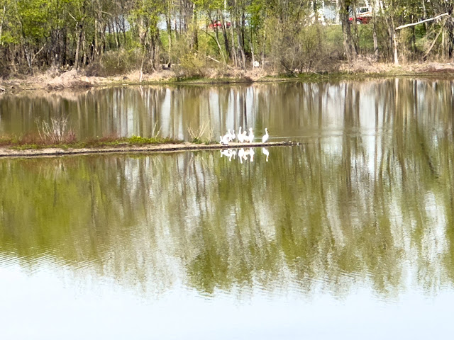 |
| White pelicans on the Mississippi River |
 |
| Nickel Plate bike path to Edwardsville, IL |
I was disappointed to not see the St. Louis arch. A picture with Myrtle and the arch in the background seemed iconic. Unfortunately, riding into St. Louis from the end of the KATY trail is more than 20 miles. The ride is complicated and not recommended. Instead, I crossed the Mississippi River at Alton, IL. There is a bike lane on the bridge and it put me right at an entrance to the Mississippi River bike route. This route goes the length of the Mississippi River on levee paths. It was fun to be on this path which I took south for about 10 miles where I turned off to start riding east. For this part of the tour through Illinois, Indiana, Ohio, and to the start of the GAP trail in Pennsylvania, I was going to be relying on Google Maps bike routing and RideWithGPS where ever possible. I put a route to Pocahontas where I had a hotel reservation into Google Maps and followed with turn-by-turn directions in my Airpods. There was an industrial section through South Roxanna where I was on rough roads chewed up by heavy commercial traffic. Even though there wasn't a bike lane, the road was wide and I felt safe enough. Coming into Edwardsville, Google found a series of bike paths. This was a big surprise. Edwardsville is a cute college town.
After Edwardsville, I rode on country farm roads through the town of Grand Forks where I expected to find a grocery store. Unfortunately, there wasn't one. I continued on into Pocahontas which is a very small town on Hwy 70. Country music star, Gretchen Wilson, grew up here and that seems to be the claim to fame for this town. There were also quite a few weathered-looking antique stores. The highway sign for the hotel had pieces missing which made me wonder about the quality. Turns out a powerful wind storm had blown through a week ago damaging the sign. The Powhattan motel turned out to be a very nice find. The room was tastefully designed with very comfortable bedding. The quality surprised me.
 |
| Huge meatloaf dinner from the Powhattan motel restaurant |
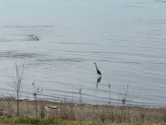 |
| Great blue heron |
The motel was old enough that the doors are too narrow for my trike to fit through. I ordered some food at the restaurant and asked if anyone could help me lift the trike through the doorway. The cook came out to help and also offered to help, again, in the morning. I ordered the meatloaf special which was a huge amount of food. I'm going to have to remember to plan for grocery store stops on each day's route.
************************************************************************************
Please click here to become a member of my Patreon. You can join for as little as $1 per month
To make a direct donation please click here
***********************************************************************************
The next morning was another beautiful day and I started cycling in short sleeves. A follower and his son, Ron and Brett, had sent me a route inspired by a couple of upright cyclists who did a cross-country tour. I think Ron and Brett put a lot of time and effort to recreate the route in Ride With GPS. The route followed Hwy 50 but stayed on adjacent farm roads. They plotted a route from the KATY to the start of the GAP trail in Pittsburgh. This route was over 1,000 miles with 30,000 ft of climbing. The map included some accommodation and cafe recommendations as well. I really appreciated the helpful route.
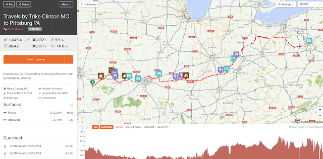 |
| Route that Ron and Brett designed for me |
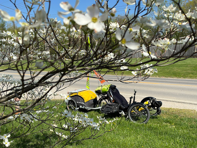 |
| Myrtle through the Dogwood tree flowers |
 |
| Beautiful blooming pink and white Dogwood trees |
All day, I was on beautiful, quiet farm roads. Maybe a hand full of cars passed me throughout the day. A couple of times the route put me on gravel. I'm really not set up for gravel riding and prefer staying on pavement. I was able to look at Google maps on my phone and easily find paved alternative roads. I found a nice hotel in Altamont on the Hwy.
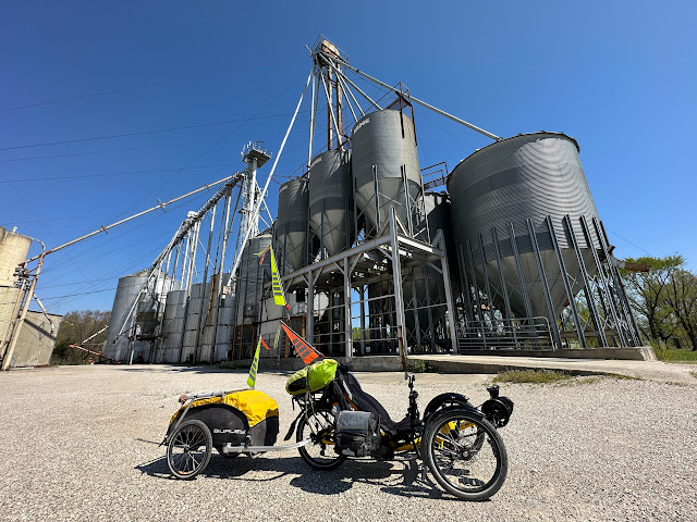 |
| Myrtle and the big farms |
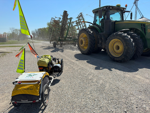 |
| Sharing the road |
The temperature was certainly warm enough to camp but I couldn't find any campgrounds. This area is all farming. Even the towns are too small to have a city park that, sometimes, will allow camping. I wondered if I would find any camping opportunities through the section of my route in Illinois. Leaving Altamont on another beautiful day felt like such a luxury. I really prefer heat to cold. I'm sure, soon enough, the weather will turn hot and humid but, for now, I was loving this weather. Again today, the roads were on very quiet farm roads. Most of the traffic I experienced was giant farm equipment being moved from field to field. The farmers seemed to enjoy seeing me out there and I got lots of waves and honks. I love the farmers. Tonight there was a big storm brewing and I probably wouldn't have been able to camp anyway. Heavy rain with strong winds was forecast for the next couple of days. I found a comfortable hotel in Olney to remain safe and dry. Olney is famous as the home of the white squirrel.
 |
| Home of the white squirrel |
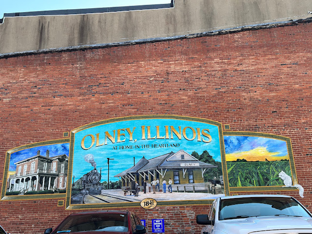 |
| Olney mural |

.png)